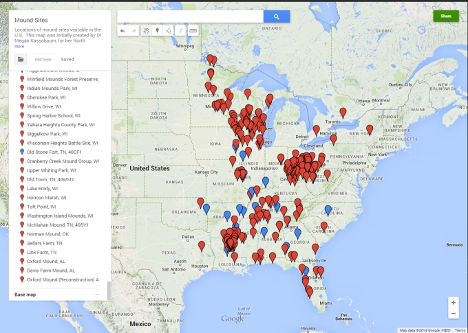
Here’s an interesting crowd-sourcing archaeology project by Dr. Megan Kassabaum at the University of Pennsylvania. Kessabaum has created a Google Map with place pins for visitable mound sites in the United States. The map was launched on December 8th, 2014 and is editable, so can be added to and improved by anyone.
Google map created by Dr. Megan Kassabaum (http://goo.gl/wsCfNF)
In the description, Kessabaum notes:
Please add only sites that are open to the public (i.e., in parks, archaeological preserves, etc.) or are viewable from public land (i.e., privately owned sites with historical markers on the road). Non-publicly viewable sites should be removed. Photos, information about viewing the site, and other notes such as date, cultural associations, etc. may be added for each site. Most sites will be labeled red (the default color), but sites marked in blue have attached museums.
Do you know of a visitable mound sites that can be added to the map?
